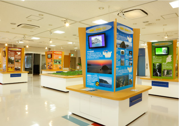
Geopark Floor (1st Floor)

Learn about the unique geological and geographical formations created here and what Kami-cho has to offer as a geo spot. Real fossils are on display here.
Learn about the formation of the Japanese archipelago
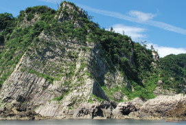
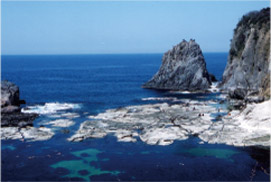
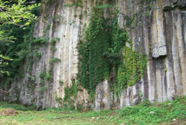
San’in Kaigan Geopark maintains many natural and historical formations that span from when the Japanese archipelago was a part of the larger Asian continent in ancient times, to the formation of the Sea of Japan, to the present. The formation of various geographical phenomena at San’in Kaigan Geopark spans three distinct periods: when Japan was still physically attached to the Asian landmass; when Japan detached from Asia and the Sea of Japan was formed; and the period from that time to the present.

San’in Kaigan Geopark Area
“Geo” is a root word referring to the Earth and land, so Geopark is a title given to natural park areas that have important scientific significance or natural beauty.
Geology and topography are deeply implicated in the history and culture of the world. Geoparks offer a place to learn about the importance of the Earth and its development.
The Geopark system was established in 2004 under the support of UNESCO through the Global Geoparks Network (GGN).
Geo spots in Kami-cho
> Go!Geopark – Around Geo spots
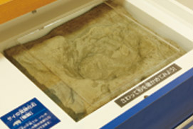
The panels around the central dioramas explain the topography of Kami-cho. Video display monitors, information panels, and fossils are exhibited here, with other reference materials and drawers containing artifacts on view. Explore the geo spots around Kami-cho from various new vantage points. This is a great place to think about what other geo spots you may like to visit.
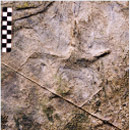
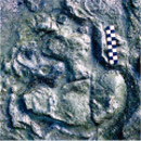
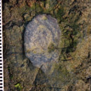
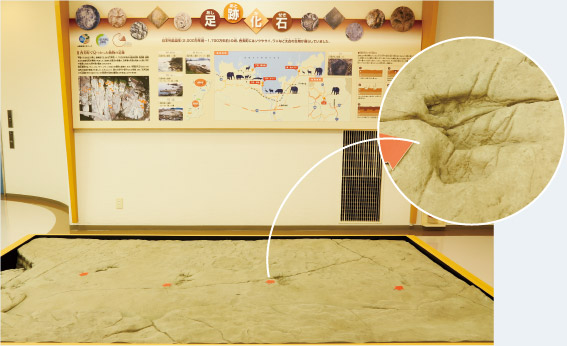
Fossilized footprints
> Go!Geopark – Around Geo spots
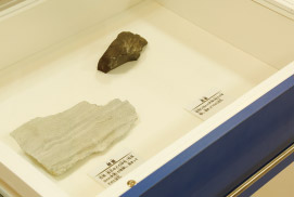
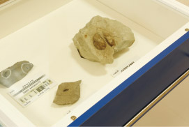
In 2003, fossilized remains of large mammals, reptiles, and birds dating to 17-20M years ago were discovered in Kami-cho. The strata around the fossilized remains is the result of solidified sand and mud that pooled in the rivers and swamps when the Sea of Japan was formed. The Kasumi coastline exhibits the footprints of the early ancestors of crocodiles, cranes, rhinoceros, elephants, and deer, among others. Footprints of the ancestor to the elephant were also found at the inlet at Muraoka-ku. These valuable discoveries allow for making insights about their gait when walking and running, lifestyles, the climate at the time, and the possibility of the north of Kyushu and the Hokuriku area having been contiguously connected.
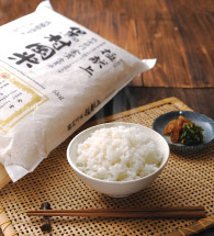
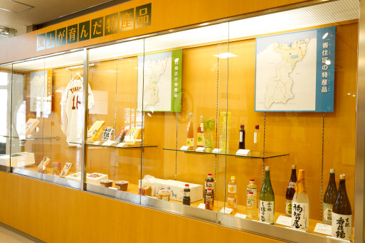
Unique local specialties
Local specialties of Kami-cho are featured alongside panels describing the corresponding geo spot and exhibited in large showcases.
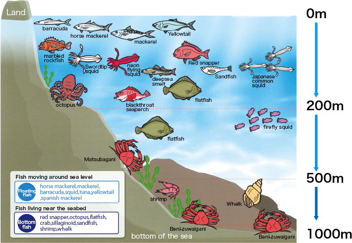
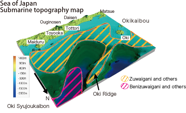
Seafood from the Sea of Japan
One unique aspect of the Sea of Japan off the coast of the San’in Kaiagan Geopark the existence of a protrusion on the seafloor formed when the Japanese archipelago separated from the Asian continent. At 300m and below, there is water unique to the Sea of Japan, which has a high quantity of dissolved oxygen and ranges from 0-1 degrees Celsius. Near the shore, the warm Tsushima currents flow. These two water sources are rich fishing grounds with ample plankton. Snow crabs inhabit the area from 200-400m below the surface, and red snow crabs inhabit the area from 500-2,500m below. You will also find squid, yellowtail, horse mackerel, shore dotterel, and more.
■Water depths at which prominent fish are found
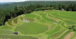
Produce from terraced fields of Nishigaoka and Ueyama
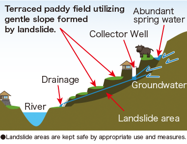
Terraced fields consist of ridges between each tier in which water pools. This prevents rainwater from rushing down the slope of the hill, and controlling the flow of water. Given their scenic beauty throughout the four seasons, the terraced fields at Nishigaoka (Wasabu, Muraoka-ku) and Ueyama (Nukida, Ojiro-ku) have been selected as among Japan’s 100 finest terraced fields.
Terraced rice fields and sloping formations
The majority of terraced fields are the result of using gentle sloping formations produced from landslides in the past. Areas prone to landslides have many springs of water, offering fertile water for rice cultivation. Furthermore, the landslides cause the soil to intermingle deep below the surface, enriching its structure. Terraced rice fields require a unique soil structure and clean mountain water and air, as well as sharp swings in temperature, which raise the rice to maturity and give it a fine flavor by increasing its glucose content, resulting in a rice that it sweet and tasty.
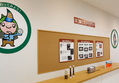
Experiential area
This area offers intuitive explanations of how the topography and geology of the region work. Here you can learn about how strata, faults, and folds are formed, as well as how earthquakes occur.